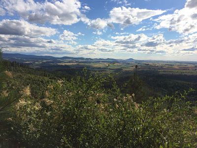
In so. Idaho, BLM land, in particular, can be easily mixed up with private land. I use an onXmap on my gps that clearly shows which is which but without that, it's hopeless to sort them out. Even the BLM people didn't always know where the borders are. Out in the deserts and hills, many times you'll have 200 square miles of BLM land with a handful of 1/4 to 1/2 section parcels of totally undeveloped private land scattered around. I have no idea why those parcels were originally claimed. They're much of the reason this trespass law was created.
Thanks for the input. I will have to look into a GPS and onXmap. I never worry about finding my way back to the truck in North Dakota. That will likely be a much different issue in Idaho.
Go to the the USFS office off Sherman. There is an exit off I-90 East of town. You can buy a USFS travel maps for the Panhandle, Kaniksu, and Clearwater NF. These have the BLM in yellow, USFS in various shades of green, Corporate Timber in various other colors. State School sections and University of Idaho forest lands are marked also. The arterial routes will always be open but you cannot trust that other roads on the map will not be gated. There are many seasonal closures. Most are open during Archery but will be closed to full sized rigs during rifle. My maps are many years old and have served me well. USFS publishes an addendum booklet each year showing the road access changes.
Many corporate timber companies require a sportsman's permit to park your rig on their roadways. Clearwater Paper (Potlatch) runs about $80/year. You can put the license plates of the vehicles you intend to drive on it. They can charge you with trespass if you don't have one. Clearwater Paper also has a disabled Hunter permit that lets you drive through the gates. Go here to purchase if you need one.
http://recreation.potlatchcorp.com/ID/ There are no fees to access State lands.
In the deep timber it is easy to lose your truck.