|
|
Joined: Feb 2011
Posts: 40
Campfire Greenhorn
|
OP

Campfire Greenhorn
Joined: Feb 2011
Posts: 40 |
Why do people need a compass when the sun is up? Am I the only one who orients themselves based on a map/ time of year and just understands their place on a map? I mean the sun doesnt change its angle much throughout a 2 week span. Or am i missing something here.
|
|
|
|
|
Joined: Jan 2006
Posts: 69,443 Likes: 14
Campfire Kahuna
|
|
Campfire Kahuna
Joined: Jan 2006
Posts: 69,443 Likes: 14 |
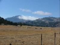
I don't have to drive many miles to be in areas of high flat desert where you can get totally screwed up on a cloudy day. It all looks the same for many miles and if the clouds are low, you can't even see the mountains in the distance.
Last edited by Rock Chuck; 08/21/18.
“In a time of deceit telling the truth is a revolutionary act.”
― George Orwell
It's not over when you lose. It's over when you quit.
|
|
|
|
|
Joined: Oct 2008
Posts: 8,748
Campfire Outfitter
|
|
Campfire Outfitter
Joined: Oct 2008
Posts: 8,748 |
Thick clouds.
Yes, if the sun is up you don’t need one. However, when you find yourself navigating a couple miles in unfamiliar territory in a driving rain with the sun setting you’ll appreciate a compass. I now have one tied to my pack and a small one on my watchband.
|
|
|
|
|
Joined: Jul 2007
Posts: 24,653 Likes: 1
Campfire Ranger
|
|
Campfire Ranger
Joined: Jul 2007
Posts: 24,653 Likes: 1 |
Why do people need a compass when the sun is up? Am I the only one who orients themselves based on a map/ time of year and just understands their place on a map? I mean the sun doesnt change its angle much throughout a 2 week span. Or am i missing something here. Do you only hunt on sunny days? What sort of terrain do you hunt 90% of the time?
![[Linked Image from i.imgur.com]](https://i.imgur.com/X0n16mr.png) WWP53D
|
|
|
|
|
Joined: Jan 2006
Posts: 69,443 Likes: 14
Campfire Kahuna
|
|
Campfire Kahuna
Joined: Jan 2006
Posts: 69,443 Likes: 14 |
About 15 years ago my partner and I drew moose tags just west of Yellowstone. One morning we planned to hunt a canyon that paralleled the road about 1/2 mile away. The terrain was almost totally flat, moderate timber, and no underbrush. It was heavily overcast and snowing lightly. My partner took off from the truck on the road and headed for the canyon with me behind him. We'd gone about 1/2 way when things just didn't feel right to me. I pulled out my compass. We were supposed to going due south but my compass said due north. I was just getting ready to tap him on the shoulder when he walked out on the road only 200 yards from the truck. I thought it was a lot funnier than he did. The ol' dominant leg trick proved itself that day.
“In a time of deceit telling the truth is a revolutionary act.”
― George Orwell
It's not over when you lose. It's over when you quit.
|
|
|
|
|
Joined: Sep 2004
Posts: 14,186 Likes: 1
Campfire Outfitter
|
|
Campfire Outfitter
Joined: Sep 2004
Posts: 14,186 Likes: 1 |
We were hunting in Wyoming a few year ago. We left in the morning with sunny sky's, by mid morning you couldn't see 10 yds. The fog was so thick. That's why you need one!!
Well we're Green and we're Gold, and we play better when it's cold. All us Cheese heads have our favorite superstar. We love Brett Favre.
|
|
|
|
|
Joined: Jun 2006
Posts: 46,148 Likes: 7
Campfire 'Bwana
|
|
Campfire 'Bwana
Joined: Jun 2006
Posts: 46,148 Likes: 7 |
Lots of uses for a compass besides orienting yourself.
A wise man is frequently humbled.
|
|
|
|
|
Joined: Aug 2006
Posts: 22,945 Likes: 18
Campfire Ranger
|
|
Campfire Ranger
Joined: Aug 2006
Posts: 22,945 Likes: 18 |
The point of a compass is magnetic north. So, there....
|
|
|
|
|
Joined: Jan 2006
Posts: 7,205
Campfire Tracker
|
|
Campfire Tracker
Joined: Jan 2006
Posts: 7,205 |
Makes me feel guilty, I have never used a compass in the woods. On a boat in the ocean yes, but never in the outdoors.
|
|
|
|
|
Joined: Jan 2012
Posts: 9,397
Campfire Outfitter
|
|
Campfire Outfitter
Joined: Jan 2012
Posts: 9,397 |
Anyone who asks that question would probably not understand the answer.
mike r
Don't wish it were easier
Wish you were better
Stab them in the taint, you can't put a tourniquet on that.
Craig Douglas ECQC
|
|
|
|
|
Joined: Jun 2006
Posts: 46,148 Likes: 7
Campfire 'Bwana
|
|
Campfire 'Bwana
Joined: Jun 2006
Posts: 46,148 Likes: 7 |
Makes me feel guilty, I have never used a compass in the woods. On a boat in the ocean yes, but never in the outdoors. What's the best lightweight solar charger for your compass?
A wise man is frequently humbled.
|
|
|
|
|
Joined: Oct 2013
Posts: 8,490
Campfire Outfitter
|
|
Campfire Outfitter
Joined: Oct 2013
Posts: 8,490 |
Makes me feel guilty, I have never used a compass in the woods. On a boat in the ocean yes, but never in the outdoors. Obviously you have never wandered into the fall woods on the upper peninsula of Michigan.
Writing here is Prohibited by the authorities.
|
|
|
|
|
Joined: Jan 2012
Posts: 9,397
Campfire Outfitter
|
|
Campfire Outfitter
Joined: Jan 2012
Posts: 9,397 |
I thought everyone knew that you just look on the side of trees for moss to indicate North. This plan requires modification in the desert or above treeline.
mike r
Don't wish it were easier
Wish you were better
Stab them in the taint, you can't put a tourniquet on that.
Craig Douglas ECQC
|
|
|
|
|
Joined: Sep 2004
Posts: 14,186 Likes: 1
Campfire Outfitter
|
|
Campfire Outfitter
Joined: Sep 2004
Posts: 14,186 Likes: 1 |
The point of a compass is magnetic north. So, there.... I was waiting for that!!
Well we're Green and we're Gold, and we play better when it's cold. All us Cheese heads have our favorite superstar. We love Brett Favre.
|
|
|
|
|
Joined: Mar 2006
Posts: 20,918 Likes: 1
Campfire Ranger
|
|
Campfire Ranger
Joined: Mar 2006
Posts: 20,918 Likes: 1 |
Or am i missing something here. Yes!
"I never thought I'd live to see the day that a U.S. president would raise an army to invade his own country."
Robert E. Lee
|
|
|
|
|
Joined: Oct 2000
Posts: 30,291 Likes: 2
Campfire 'Bwana
|
|
Campfire 'Bwana
Joined: Oct 2000
Posts: 30,291 Likes: 2 |
The point of a compass is magnetic north. So, there.... Dammit man, stole my line 
“Perfection is Achieved Not When There Is Nothing More to Add, But When There Is Nothing Left to Take Away” Antoine de Saint-Exupery
|
|
|
|
|
Joined: Oct 2000
Posts: 30,291 Likes: 2
Campfire 'Bwana
|
|
Campfire 'Bwana
Joined: Oct 2000
Posts: 30,291 Likes: 2 |
Or am i missing something here. Yes! +1 I don’t think your experience extends to thick, deep, dark woods where you can’t see the horizon, and might be able to only see 15’ in front of yourself.
“Perfection is Achieved Not When There Is Nothing More to Add, But When There Is Nothing Left to Take Away” Antoine de Saint-Exupery
|
|
|
|
|
Joined: Jan 2006
Posts: 69,443 Likes: 14
Campfire Kahuna
|
|
Campfire Kahuna
Joined: Jan 2006
Posts: 69,443 Likes: 14 |
We were hunting in Wyoming a few year ago. We left in the morning with sunny sky's, by mid morning you couldn't see 10 yds. The fog was so thick. That's why you need one!! Oh, the fog. One time my folks were camping near Port Angeles, WA. Dad took his small boat out on the sound one blue bird morning. He was navy with old habits so he took a bearing when he left the dock. A couple hours later, pea soup fog rolled in. Dad set his compass down on the seat next to him and followed it back. He hit shore only a couple hundred yards from the dock. He could have found shore simply by going south, but he wouldn't have been anywhere close to the dock. Without the compass, though, he could have ended up in Alaska.
“In a time of deceit telling the truth is a revolutionary act.”
― George Orwell
It's not over when you lose. It's over when you quit.
|
|
|
|
|
Joined: Mar 2007
Posts: 20,268 Likes: 19
Campfire Ranger
|
|
Campfire Ranger
Joined: Mar 2007
Posts: 20,268 Likes: 19 |
I barely know how to turn my GPS on, and do so only a couple times a year and only to see how far I have walked.
Other than that it is all by map and when the fog sets in, in deep timber or when you're hiking somewhere new in the dark, a compass is invaluable.
Last edited by T_Inman; 08/21/18. Reason: grammar
|
|
|
|
|
Joined: Jan 2010
Posts: 32,130 Likes: 1
Campfire 'Bwana
|
|
Campfire 'Bwana
Joined: Jan 2010
Posts: 32,130 Likes: 1 |
The point of a compass is the end that points north.
If you put Taco Bell sauce in your ramen noodles it tastes just like poverty
|
|
|
|
|
Joined: Jan 2006
Posts: 69,443 Likes: 14
Campfire Kahuna
|
|
Campfire Kahuna
Joined: Jan 2006
Posts: 69,443 Likes: 14 |
I barely know how to turn my GPS on, and do so only a couple times a year and only to see how far I have walked.
Other than that it is all by map and when the fog sets in, in deep timber or you're when hiking somewhere new in the dark, a compass is invaluable. I use a GPS all the time. It does some amazing things. However, I try to stay proficient with a compass and map and carry them in my pack. It's easy to get complacent with them, though.
“In a time of deceit telling the truth is a revolutionary act.”
― George Orwell
It's not over when you lose. It's over when you quit.
|
|
|
|
|
Joined: Dec 2013
Posts: 13,139 Likes: 9
Campfire Outfitter
|
|
Campfire Outfitter
Joined: Dec 2013
Posts: 13,139 Likes: 9 |
"What's the point of a compass" When all else fails is a good reason to have one. It works day or night , fair weather or foul, doesn't require charging, and it is a friend that will tell you that you are wrong when you are.
Patriotism (and religion) is the last refuge of a scoundrel.
Jesus: "Take heed that no man deceive you."
|
|
|
|
|
Joined: May 2006
Posts: 266
Campfire Member
|
|
Campfire Member
Joined: May 2006
Posts: 266 |
A compass is flat out useless if you don't know how to use one. Its an extremely valuable tool if you learn how to use one. They don't weigh much, need batteries, or stop working when you loose satellites. With the knowledge of how to use a compass and an accurate map you can always know your location.
|
|
|
|
|
Joined: Feb 2003
Posts: 8,854
Campfire Outfitter
|
|
Campfire Outfitter
Joined: Feb 2003
Posts: 8,854 |
I'm apparently the only wuss here. I never head to the woods without a compass and usually a map. I've been disoriented in fog, swamps, and in the dark.
Adversity doesn't build character, it reveals it.
|
|
|
|
|
Joined: Oct 2000
Posts: 30,291 Likes: 2
Campfire 'Bwana
|
|
Campfire 'Bwana
Joined: Oct 2000
Posts: 30,291 Likes: 2 |
I'm apparently the only wuss here. I never head to the woods without a compass and usually a map. Where did you get that idea? I always have the 10 Essentials with me, even on a sunny summer dayhike. The mountains can kill you. A map and compass are one of the ten...
“Perfection is Achieved Not When There Is Nothing More to Add, But When There Is Nothing Left to Take Away” Antoine de Saint-Exupery
|
|
|
|
|
Joined: Jul 2007
Posts: 24,653 Likes: 1
Campfire Ranger
|
|
Campfire Ranger
Joined: Jul 2007
Posts: 24,653 Likes: 1 |
Why do people need a compass when the sun is up? Am I the only one who orients themselves based on a map/ time of year and just understands their place on a map? I mean the sun doesnt change its angle much throughout a 2 week span. Or am i missing something here. A post of yours from 2011 - my, how thing's have changed.  Depending on what your willing to give up, new smartphones nowadays have a great ability to do what you need. For instance, i have a newer android phone and it provides me with a wide variety of apps for what i need. This paired with the gps feature helps me tremendously. Google maps gets me to where i need to go and has roads on it that i dont think are even roads anymore. Since i hunt in montana i use montana parcel app. This is a satellite view of an area. Kinda similar to google maps, but when i click on a certain area on the screen it shows me who owns the parcel and its boundaries. I also have a navionics app for lakes. it ties in with my GPS and shows me all my info of where i am on a lake my speed, and the lake contour. I found that i can change the map overlay to terrain and look at the terrain anywhere in the US. I also use this for planning my hunts in montana as i can find elevation/angles among other things. I have not yet taken my phone into the field as a carry along GPS/smartware system, but this year i might. I'll probably get a mostly water resistant case/ bag and carry it along. With the apps above i can track routes avg speed, set waypoints. Anything a traditional GPS can do plus a whole lot more. I have an extra battery for it in case mine dies, so i tihnk i am ready. My only concern for this item would be durability. Do i really want to drop my phone off a cliff or in water.... But i think the pros outweigh the chance/probability that this might happen. Also i have an app that calculates ballistics for alot, Shooter. Its ties in with GPs/weather for this also. I'm sure theres more great apps out there. If i were you i'd definetly look into this.
WWP53D
|
|
|
|
|
Joined: Dec 2015
Posts: 8,069
Campfire Outfitter
|
|
Campfire Outfitter
Joined: Dec 2015
Posts: 8,069 |
I'm apparently the only wuss here. I never head to the woods without a compass and usually a map. I've been disoriented in fog, swamps, and in the dark. I always have a compass, I guess it's the old army training in me. Heck, I've been disoriented out in the prairie at dark.
|
|
|
|
|
Joined: Jun 2006
Posts: 46,148 Likes: 7
Campfire 'Bwana
|
|
Campfire 'Bwana
Joined: Jun 2006
Posts: 46,148 Likes: 7 |
I'm apparently the only wuss here. I never head to the woods without a compass and usually a map. I've been disoriented in fog, swamps, and in the dark. I usually only get dazed and confused sitting around the campfire at night, tumbler in hand......
A wise man is frequently humbled.
|
|
|
|
|
Joined: Oct 2008
Posts: 8,748
Campfire Outfitter
|
|
Campfire Outfitter
Joined: Oct 2008
Posts: 8,748 |
If there is any terrain I can typically navigate without any aids. On the other hand, the areas of perfectly flat eastern woods can be rather difficult to nav in the dark or very thick overcast. I have one tree stand in a perfectly flat section of woods and it always amazes me how easy it is to have your mental compass shift.
|
|
|
|
|
Joined: Jan 2001
Posts: 29,929 Likes: 10
Campfire Ranger
|

Campfire Ranger
Joined: Jan 2001
Posts: 29,929 Likes: 10 |
Heavy overcast ceiling, fog, darkness, snow, and any of the previous paired with an absence of topography. Also its batteries never fail. It also helps to have some knowledge of the terrain and the relative positions of ones objectives. Fog and heavy ceilings have been my major issues and I once did a complete circle in Alaska's foggy alders before getting out my equipment. Still, one could sail the seas for years with a compass and never find Hawaii, so it's not the end all for serious long distance navigation.
GPS is the absolute mindless ultimate. With 5 minutes of schooling one could leave and tie up at the correct boat cleat in Hawaii. It's only shortcoming is batteries.
Last edited by 1minute; 08/22/18.
1Minute
|
|
|
|
|
Joined: Jun 2006
Posts: 46,148 Likes: 7
Campfire 'Bwana
|
|
Campfire 'Bwana
Joined: Jun 2006
Posts: 46,148 Likes: 7 |
Batteries, and its an electronic device that can malfunction even with satellite reception and charged batteries. I've seen it happen.
A wise man is frequently humbled.
|
|
|
|
|
Joined: Feb 2018
Posts: 369
Campfire Member
|
|
Campfire Member
Joined: Feb 2018
Posts: 369 |
The National Forest I spend most of my time in is very very dense, it’s easy to get turned around because it’s all underbrush and pines, plus it’s flat. And a lot of times it’s cloudy or dark when I’m coming in/out of the woods. If I get turned around, all I have to do is know which general direction the road is, and follow my compass to the road. Once I hit a road, finding my way to the truck is no issue. I use OnX maps to mark most of my spots and I can use it to navigate out but have been known to forget to charge up my phone the night before. Most of the time I can get out on my own, but there’s been a few incidents that had me a little worried and I was glad I could use a compass.
|
|
|
|
|
Joined: Jan 2001
Posts: 4,313
Campfire Tracker
|
|
Campfire Tracker
Joined: Jan 2001
Posts: 4,313 |
Why do people need a compass when the sun is up? Am I the only one who orients themselves based on a map/ time of year and just understands their place on a map? I mean the sun doesnt change its angle much throughout a 2 week span. Or am i missing something here. We have a lot of cloud cover, especially during deer season. It's possible to not see the sun for a week.
Brushbuster: "Is this thread about the dear heard or there Jeans?"
Plugger: "If you cant be safe at strip club in Detroit at 2am is anywhere safe?"
Deer are somewhere all the time
To report a post you disagree with, please push Alt + F4. Thank You.
|
|
|
|
|
Joined: Jan 2008
Posts: 1,407
Campfire Regular
|
|
Campfire Regular
Joined: Jan 2008
Posts: 1,407 |
Smokepole is correct. I have had 2 different Garmin GPS fail. One had an internal battery fail. The other failure was a complete loss of internal software. Fresh batteries did not fix either malfunction.
|
|
|
|
|
Joined: Nov 2007
Posts: 29,663 Likes: 5
Campfire Ranger
|
|
Campfire Ranger
Joined: Nov 2007
Posts: 29,663 Likes: 5 |
I'm apparently the only wuss here. I never head to the woods without a compass and usually a map. I've been disoriented in fog, swamps, and in the dark. After growing up in the country and being outside all the time in a relatively small piece of land in the Midwest I never carried a compass. Then I went fishing with a buddy whose background was identical to mine and we got LOST LOST. Now even when on a well marked trail in an area we know well we have compasses. We have taught our kids to use them too. As has been said in the pitch black, fog, or WHEN (GPS) batteries go dead it’s a lifesaver.
|
|
|
|
|
Joined: Jan 2001
Posts: 5,611
Campfire Tracker
|
|
Campfire Tracker
Joined: Jan 2001
Posts: 5,611 |
Why do people need a compass when the sun is up? ...am i missing something here. Yes. Is this a troll post to provoke?  As said, when you most need direction, you can't see the sun. Like others here, I've seen the sun disappear totally within minutes, with no warning, and not show again for days. That is extra bad 100 miles out in the endless forest and swamp plateaus of central BC and many other places. And a general heading south by clear sun may not be accurate enough when a 195 heading is critical to find a camp in the woods. Besides the basics I use a compass to find blood trails and down game across a canyon or swamp from me, as described in a post long ago. Have also used a compass to precisely stalk bedded game I have spotted. I ain't keen on trusting my life to something that runs on batteries when I have a backup. Walking a heading by compass is easier for me than following a GPS screen, but maybe I don’t know the tricks of the device.
|
|
|
|
|
Joined: Jan 2001
Posts: 8,235 Likes: 1
Campfire Outfitter
|
|
Campfire Outfitter
Joined: Jan 2001
Posts: 8,235 Likes: 1 |
Thick clouds.
Yes, if the sun is up you don’t need one. However, when you find yourself navigating a couple miles in unfamiliar territory in a driving rain with the sun setting you’ll appreciate a compass. I now have one tied to my pack and a small one on my watchband. +1! What's this "Sun" you speak of? Combine no sun with flat terrain and unbroken forest and you've got the recipe to get a might-bit turned around.  
Last edited by Teeder; 08/27/18.
|
|
|
|
|
Joined: Mar 2004
Posts: 6,065
Campfire Tracker
|
|
Campfire Tracker
Joined: Mar 2004
Posts: 6,065 |
Obviously the OP is a bit shy of overall outdoor experience--really outdoors, I mean out of town and all....but it is ok, he can get some. You guys ever have the sun go down before you get back to camp? I think that is still allowed. Haven't checked the regulations book lately.
Last year, my BIL and I were stillhunting a new area in the UP. Had compass and GPS. A single lumber road was it for our 2hr scout timeframe and we started off it. Meet back in two hours. Right. My compass read exactly opposite of what it should and it took me a while before I pulled the GPS out. Hadn't eaten any mushrooms and it was clouded low with a storm blowing in, so figuring out the compass was lying like a politician and believing the GPS was not too difficult. But disconcerting. Got back, and showed BIL who had the exact make and sure enough gave North for my South. A first for me....but will check from now on.
BIL still bitched about me being late. He said there was no excuse.
I kept the damn thing and it still reads 180 degrees off even in iron free zones. Gonna give it to a democrat the first chance I get.
Defend the Constitution
|
|
|
|
|
Joined: Oct 2016
Posts: 8,109
Campfire Outfitter
|
|
Campfire Outfitter
Joined: Oct 2016
Posts: 8,109 |
Just means the magnet or needle is backwards. Poor assembly. A magnet, and a pin or nail, floated on bark in a puddle will show the same N-S line. A compass works well, when you have tree canopy blocking your view.
An unemployed Jester, is nobody's Fool.
the only real difference between a good tracker and a bad tracker, is observation. all the same data is present for both. The rest, is understanding what you're seeing.
~Molɔ̀ːn Labé Skýla~
|
|
|
|
|
Joined: Mar 2004
Posts: 6,065
Campfire Tracker
|
|
Campfire Tracker
Joined: Mar 2004
Posts: 6,065 |
A guy sure can learn some stuff on the internet...
Defend the Constitution
|
|
|
|
|
Joined: Oct 2016
Posts: 8,109
Campfire Outfitter
|
|
Campfire Outfitter
Joined: Oct 2016
Posts: 8,109 |
A guy sure can learn some stuff on the internet...
Boy scouts, actually.
An unemployed Jester, is nobody's Fool.
the only real difference between a good tracker and a bad tracker, is observation. all the same data is present for both. The rest, is understanding what you're seeing.
~Molɔ̀ːn Labé Skýla~
|
|
|
|
|
Joined: Mar 2004
Posts: 6,065
Campfire Tracker
|
|
Campfire Tracker
Joined: Mar 2004
Posts: 6,065 |
My wife related some of the orienteering lessons she had in girls scouts back in the day--they were less concerned about PC then and actually learned something of value.
When the ground water is frozen, puddles are scarce...
We have been spanked by Lake Superior one or two times and storms coming off of her can be exciting. But fortunately, knowing the wind rotation of an approaching low pressure area can give a guy a pretty good clue. That was mine as I failed to cut my backtrail.
Defend the Constitution
|
|
|
|
|
Joined: Feb 2005
Posts: 9,472
Campfire Outfitter
|
|
Campfire Outfitter
Joined: Feb 2005
Posts: 9,472 |
Compass is very useful for hiking out in the dark.
|
|
|
|
|
Joined: Nov 2013
Posts: 28,879 Likes: 13
Campfire Ranger
|
|
Campfire Ranger
Joined: Nov 2013
Posts: 28,879 Likes: 13 |
If you need a gps, you also need a compass, and maybe a paper map to boot.
Was exploring a small WMA a couple years back and wanted to compare what my brain told me with what the gps thought. The gps in my "smart" phone said I was standing in the Shenandoah River, which was about a mile away.
The little Backtrackers Bushnell makes are cheap and, if you remember to set them before you leave your starting point, will get you back there. So far, knock on wood, mine has been spot on. It also works as an electronic compass, but I still carry a real one.
What fresh Hell is this?
|
|
|
|
|
Joined: Aug 2010
Posts: 1,027
Campfire Regular
|
|
Campfire Regular
Joined: Aug 2010
Posts: 1,027 |
Years ago when I first started making some overnight hikes, I decided to learn how to use a map and compass. This was before GPS was common. I read and studied a book entitled "Be Expert with Map and Compass" by Bjorn Kjellstrom. I purchased the book from the old CampMor catalog. Anyone else remember the old CampMor catalogs that were illustrated on phone book-type paper? The end of each chapter includes quizzes and exercises just like a school text book to ensure that you can apply what you've just read.
After studying this book and doing the exercises, I was pretty confident that I could navigate successfully in just about any conditions so long as I had a good compass and a topo map. I used the knowledge while backpacking, and it works. Unfortunately, after many years of using a GPS and not nearly as much time off the beaten path in recent years, I forgot a lot of the skills I had learned.
One example of where a compass would come in handy as opposed to just looking at the sky to navigate is in a situation where intentionally "aiming off" your intended objective can save lots of confusion. Let's say you're headed for a unfamiliar river crossing located on a map and need to make it to a bridge to get across. Rather than taking a bearing directly to the bridge, it would be wise to aim off either above or below the bridge. Chances are when you navigate to a specific location miles away without a GPS, you will end up missing the objective by some margin. So if you arrive at the river without the bridge in sight, how would you determine whether you should head upstream or downstream to get to the bridge (or vehicle, or camp, etc.)? However, if you used your compass to intentionally aim off either above or below the bridge by some degree, you would know which way to turn to find it.
It's comforting to be able to look at a topo map in unfamiliar territory and with a compass be able to pretty much know where you are and where you are going at all times without electronic aids.
Last edited by CoalCracker; 09/02/18.
|
|
|
|
|
Joined: Aug 2010
Posts: 1,027
Campfire Regular
|
|
Campfire Regular
Joined: Aug 2010
Posts: 1,027 |
Here is another simple example showing the usefulness of a compass. In this illustration from another book I have, one can take a bearing on a well-defined landmark and hike for hours away from camp. In order to get back to camp, you just navigate until you sight the landmark at the same bearing. Then, add 180* to the bearing (i.e. turn around) and follow your compass back to camp. Aiming off about 5* would be useful in unfamiliar territory. Why guess when it can be so much easier? Also, if you had taken a second bearing to triangulate your starting point, you would have some idea how far away you were on the route back. As in the illustration, the bearing to the mountain top is 50*. Let's say you took another bearing to a big pine on a far away hilltop that was 120* from camp. As you're walking back to camp following a 230* back bearing from the mountain top (50* + 180*), the closer your bearing gets to 120* from the big pine as you walk, the closer you are getting to camp. Camp should be located where 50* to the mountaintop and 120* to the big pine intersect. ![[Linked Image]](http://i35.photobucket.com/albums/d160/lilredhouse/C06649D3-1A04-4917-91B7-4826CE813B7A_zpsuqq2mxqy.jpg) ![[Linked Image]](http://i35.photobucket.com/albums/d160/lilredhouse/78D69108-8D49-4F6E-BA1D-823E1DDA466D_zpsfi3wpekg.jpg) Once I started using a GPS, I bought a third book explaining how to navigate with a topo map using UTM grid lines. The book came with a UTM measuring tool (like a square protractor) for drawing UTM lines on maps. UTM makes using a GPS with a topo map much easier than using latitude/longitude, IMO.
Last edited by CoalCracker; 09/02/18.
|
|
|
|
|
Joined: Jun 2006
Posts: 46,148 Likes: 7
Campfire 'Bwana
|
|
Campfire 'Bwana
Joined: Jun 2006
Posts: 46,148 Likes: 7 |
The book came with a UTM measuring tool (like a square protractor) for drawing UTM lines on maps. UTM makes using a GPS with a topo map much easier than using latitude/longitude, IMO. I print my own maps, with grid lines. Any good program has that option. I know a lot of guys like UTM but I never made the switch. Six of one, half dozen of the other at least for my purposes.
A wise man is frequently humbled.
|
|
|
|
|
Joined: Aug 2010
Posts: 1,027
Campfire Regular
|
|
Campfire Regular
Joined: Aug 2010
Posts: 1,027 |
The book came with a UTM measuring tool (like a square protractor) for drawing UTM lines on maps. UTM makes using a GPS with a topo map much easier than using latitude/longitude, IMO. I print my own maps, with grid lines. Any good program has that option. I know a lot of guys like UTM but I never made the switch. Six of one, half dozen of the other at least for my purposes. Good point. Back when I got the UTM book and tool, a "good program" wasn't really an option, lol. It was before I or anyone I knew had access to a real computer. I had printed forms and used to order topo maps by mail from the USGS. Lat/Long is more confusing to me with its use of degrees/minutes/seconds needed to account for the fact that the earth is round. UTM essentially assumes the earth is flat, which works well when computing measurements in such small increments like the area of a topo map. Curvature of the earth is of little concern on such a small area. UTM is just meters. You can look at two distinct UTM coordinates and know how far they are from each other and in which direction just by finding the difference between the numbers, calculated in meters. It's easier for my simple mind to grasp.
Last edited by CoalCracker; 09/02/18.
|
|
|
|
|
Joined: Jun 2001
Posts: 32,174 Likes: 4
Campfire 'Bwana
|
|
Campfire 'Bwana
Joined: Jun 2001
Posts: 32,174 Likes: 4 |
Fog. Clouds. Whiteout. Blizzard/snow, on flat tundra or thick cover. Far out on water, or sea ice. I've been where the sun don't shine...and had GPS crap out on me. Twice. IBut I have followed that lying bastard compass to safety more than once!
Last edited by las; 09/06/18.
The only true cost of having a dog is its death.
|
|
|
|
|
Joined: Jun 2001
Posts: 32,174 Likes: 4
Campfire 'Bwana
|
|
Campfire 'Bwana
Joined: Jun 2001
Posts: 32,174 Likes: 4 |
A compass is flat out useless if you don't know how to use one. Its an extremely valuable tool if you learn how to use one. They don't weigh much, need batteries, or stop working when you loose satellites. With the knowledge of how to use a compass and an accurate map you can always know your location. "Flat out useless" is true with compass or GPS. If you don't know how to use it. As pointed out, a compass has only one working part, the pivot. Unlike GPS with high-tech chit... But compass is not exactly "always know your location". Not in my case. There is lost, Lost, and LOST!. A compass has sure prevented me in the first two from the last (sit down, build a fire - good luck in much of the Arctic - and wait for rescue!). For me, "lost" has become a comfort zone- I don't know where I am, but I know how to get out of there - with my compass! "Lost", capital L- means I try a little creative navigation to get to "lost", or better. Once, maybe twice if time permits. Then if it doesn't work, it goes to "LOST". So far it hasn't. And that advise....."Don't Panic"? Good advice. Excellent advice!! When it starts worming up from the belly, easier said than done. BTDT. If you haven't been there, you can't understand.
Last edited by las; 09/06/18.
The only true cost of having a dog is its death.
|
|
|
|
|
Joined: Mar 2004
Posts: 6,065
Campfire Tracker
|
|
Campfire Tracker
Joined: Mar 2004
Posts: 6,065 |
Its an extremely valuable tool if you learn how to use one. They don't weigh much, need batteries, or stop working...
BTDT. If you haven't been there, you can't understand.
Amen to that, Las. Particularly in big country where they may not find you...ever...or perhaps, if your wife hopes they won't...:)
Defend the Constitution
|
|
|
|
|
Joined: Sep 2018
Posts: 189
Campfire Member
|
|
Campfire Member
Joined: Sep 2018
Posts: 189 |
Like a lot of people here, I would not go hunting without one. Why experience. As a ExMarine and been to a land navigation course taught me how to use it to precision. Of all time he crap one has in there pack what does a compas weight ?
|
|
|
|
|
Joined: Aug 2006
Posts: 22,945 Likes: 18
Campfire Ranger
|
|
Campfire Ranger
Joined: Aug 2006
Posts: 22,945 Likes: 18 |
Does a good one weight more than an 'all time he crap one'?
|
|
|
|
|
Joined: Jan 2006
Posts: 69,443 Likes: 14
Campfire Kahuna
|
|
Campfire Kahuna
Joined: Jan 2006
Posts: 69,443 Likes: 14 |
Be aware that you don't want to carry your compass in the same pocket with a cell phone, turned on or not. Phones have a strong magnet in the speaker. If it's in the right position next to the compass, the magnet has been known to reverse the polarity of the needle.
In the very rare event that it should happen, the compass is still fully functional as long as you don't head off at 180 degrees.
“In a time of deceit telling the truth is a revolutionary act.”
― George Orwell
It's not over when you lose. It's over when you quit.
|
|
|
|
|
Joined: Jun 2006
Posts: 46,148 Likes: 7
Campfire 'Bwana
|
|
Campfire 'Bwana
Joined: Jun 2006
Posts: 46,148 Likes: 7 |
Does a good one weight more than an 'all time he crap one'? Depends on what he's been eatin.'
A wise man is frequently humbled.
|
|
|
|
|
Joined: Jun 2006
Posts: 46,148 Likes: 7
Campfire 'Bwana
|
|
Campfire 'Bwana
Joined: Jun 2006
Posts: 46,148 Likes: 7 |
In the very rare event that it should happen, the compass is still fully functional as long as you don't head off at 180 degrees.
If that should happen, you can just google how to reverse it. Using your phone.
A wise man is frequently humbled.
|
|
|
|
|
Joined: Dec 2001
Posts: 1,150
Campfire Regular
|
|
Campfire Regular
Joined: Dec 2001
Posts: 1,150 |
We were hunting in Wyoming a few year ago. We left in the morning with sunny sky's, by mid morning you couldn't see 10 yds. The fog was so thick. That's why you need one!! Oh, the fog. One time my folks were camping near Port Angeles, WA. Dad took his small boat out on the sound one blue bird morning. He was navy with old habits so he took a bearing when he left the dock. A couple hours later, pea soup fog rolled in. Dad set his compass down on the seat next to him and followed it back. He hit shore only a couple hundred yards from the dock. He could have found shore simply by going south, but he wouldn't have been anywhere close to the dock. Without the compass, though, he could have ended up in Alaska. Probably not Alaska but he could have put a dent in Vancouver Island or one of the San Juans
Last edited by OregonCoot; 09/14/18.
|
|
|
|
|
Joined: Oct 2017
Posts: 4
New Member
|
|
New Member
Joined: Oct 2017
Posts: 4 |
Why do people need a compass when the sun is up? ...am i missing something here. Yes. Is this a troll post to provoke? As said, when you most need direction, you can't see the sun. Like others here, I've seen the sun disappear totally within minutes, with no warning, and not show again for days. That is extra bad 100 miles out in the endless forest and swamp plateaus of central BC and many other places. And a general heading south by clear sun may not be accurate enough when a 195 heading is critical to find a camp in the woods. Besides the basics I use a compass to find blood trails and down game across a canyon or swamp from me, as described in a post long ago. Have also used a compass to precisely stalk bedded game I have spotted. I ain't keen on trusting my life to something that runs on batteries when I have a backup. Walking a heading by compass is easier for me than following a GPS screen, but maybe I don’t know the tricks of the device. It sounds like a question by your typical soft, slender-fingered millenial who thinks that everything that's important in the world is contained in a dumb-dumb phone.
|
|
|
|
|
Joined: Mar 2003
Posts: 1,421
Campfire Regular
|
|
Campfire Regular
Joined: Mar 2003
Posts: 1,421 |
It looks like you all got trolled hardcore.
"It's not the arrow, it's the Indian."
|
|
|
|
|
Joined: Jan 2005
Posts: 425
Campfire Member
|
|
Campfire Member
Joined: Jan 2005
Posts: 425 |
Is a Map basically useless in really thick, flat land? I know a lot of woods in the Northeast are so thick that you can't really get a long distance bearing. Do any experienced navigators use a Map in really thick woods?
|
|
|
|
|
Joined: Jan 2001
Posts: 5,611
Campfire Tracker
|
|
Campfire Tracker
Joined: Jan 2001
Posts: 5,611 |
Is a Map basically useless in really thick, flat land? I know a lot of woods in the Northeast are so thick that you can't really get a long distance bearing. Do any experienced navigators use a Map in really thick woods? If a map is of evenly thick and virtually flat terrain with no lakes, streams, trails, roads or any other feature shown on the map that can be identified on the ground, then a map would be of little or no use to me. I've never used a map that did not have something of interest to me that l could ID when standing on it. So yes, a map and compass can be useful in totally thick flat country and may be even more critical than in places where you can see some distance, depending on what you are doing. I usually do my map work at home, jot down heading(s) and unless I change plans while out there, seldom pull out the map while walking or hunting. When you need it you need it, however! So take it with you! I fold it to show the part of the map I'm on and put it in a Ziploc. The single most critical factor is to know where you are on the map at your starting point. That is true whether thick and flat or on a mountain peak. I would assume that there is some kind of road/trail/stream/building/pond etc. at your starting point. I'd look at the map, pick out a place that you can identify when standing on it, and use that as a starting point. Done that many times. Showing exactly where I am may be the single most valuable info a GPS gives us. Then you can travel a compass heading from that point, even if you can't see ten feet in front of you. The thicker it is the more carefully you need to navigate, and it can get tedious. I have found it easier to walk a compass heading in super thick brush and timber with two people. The man with the compass sends the other man out ahead as far as he can go and still see some tiny bit of him, and has him move right or left till he is lined up on the direction you want to walk. Then he stays there till the compass man gets to him and they repeat. Long before GPS my main hunting partner and I navigated to remote moose swamps found on a map, on a vast plateau of thick brushy timber, with only one trace of an old road or trail out on the edge somewhere. There is no sign of the swamps anywhere near the road. Again, it is absolutely critical to know your starting point precisely, and the thicker it is the more important to never wander off of a heading etc. Never lose track of exactly where you are or at least the heading to get back, until you are standing on another positively identified landmark. My best moose spot is 67 degrees magnetic from a spot on a road that is a brushy tunnel miles long with no view nor breaks of any kind. The starting point is .6 miles from an ancient crossroads of now abandoned roads. 75 yards into the thick timber my cut trail starts. I never leave the road at exactly the same place and avoid making any tracks or sign of where I left the road. I never park at the same place nor close, except a few times when loading chunks of dissected moose a moose as quickly as possible. Since getting my GPS I have lifted Google Earth coordinates of places I want to hunt that are way off trail, entered them in my GPS and used a compass to walk to them. The GPS is easier overall, but it can be done with map and compass, and I find it easier to actually walk a heading by compass rather than by GPS.
|
|
|
|
|
Joined: Apr 2007
Posts: 32,312
Campfire 'Bwana
|
|
Campfire 'Bwana
Joined: Apr 2007
Posts: 32,312 |
For me the point of a compass is to make me believe my lyin' GPS.
The CENTER will hold.
Reality, Patriotism,Trump: you can only pick two
FÜCK PUTIN!
|
|
|
|
|
Joined: Sep 2006
Posts: 2,226
Campfire Regular
|
|
Campfire Regular
Joined: Sep 2006
Posts: 2,226 |
Being "oriented" is a quickly disappearing art. If you don't believe me, take the phone away from a teenager and ask them to find an address.
I never go into the woods without a GPS, compass and relevant topo map. And, my GPS is set to the same datum as my topo (usually USGS quad). Once, I had to get to a supervisor in the GIS dept of a state government for someone to tell me what datum their online Dept of F&G maps used--like most phones, it ended up being WGS84. But, if you have navigated before with the wrong datum, you'll generally get religion quickly. Especially if it's night or with inclement weather. So, if you're picking a meetup point on a USGS map (e.g., NAD27 datum) and the other person is using a phone, there's likely already a built-in error. I see this all the time with everyone using onX cell phone maps.
I walk in the woods a lot after simply setting a bearing off my map. I periodically check my bearing and use handrails like roads or ridgelines in addition to "aiming off" so that I hit a known, well-established landmark (usually a road) then make my left or right turn. Allows me to see tons of new country while being low stress and idiot-proof.
Finally, if you're introducing a young person to the outdoors, teach them (or go to one of the many outstanding navigational courses out there, like at REI) how to navigate with a map & compass; both their enjoyment and self-reliance will go up commensurately.
Murphy was a grunt.
|
|
|
|
|
Joined: Aug 2015
Posts: 862
Campfire Regular
|
|
Campfire Regular
Joined: Aug 2015
Posts: 862 |
I never woulda thought the cell phone could mess up my compass. But I did what Rock Chuck described, and found my little compass disoriented.
|
|
|
|
|
Joined: Sep 2004
Posts: 29,383
Campfire Ranger
|
|
Campfire Ranger
Joined: Sep 2004
Posts: 29,383 |
Go 50 miles offshore in a boat depending on your GPS and no compass and you won't ask that question
|
|
|
|
|
Joined: Jun 2006
Posts: 491 Likes: 1
Campfire Member
|
|
Campfire Member
Joined: Jun 2006
Posts: 491 Likes: 1 |
I hunt a long valley up under the rim with a road and river below..Hard to get Lost lost, when you can always walk downhill for a mile or two and cut the road. Finding the quickest way back to your camp or downed elk is different. Early GPS's were a joke in the trees or during a snowstorm. Now they work pretty reliably. The nice thing about GPS is that you can follow the easiest terrain path, rather than being locked in to a bearing that might take you through blowdown, cliffs, swamps, etc. I have been disoriented in snowstorms and it is not fun. I vote for GPS now. Lithium ion batteries and dont turn it on until you need it. I mark my camp location when I start out, turn it off until I want to mark something else (a downed animal or a peculiar terrain location), then turn it off again. If I am unsure of the way home, I turn it on, take a fix, then turn it off again. Of course now, after hunting the same area for 10 years, I have most all the relevant waypoints stored and dont need to mark much except my animal. I also dont get disoriented much anymore, but there is always the next snowstorm lurking. Be aware.
|
|
|
|
|
Joined: Jan 2006
Posts: 69,443 Likes: 14
Campfire Kahuna
|
|
Campfire Kahuna
Joined: Jan 2006
Posts: 69,443 Likes: 14 |
I find that the easiest place to get screwed up isn't the mountains. It's the flat desert. You can see for miles but there's nothing to see. No landmarks at all. On a cloudy day, you can't tell what direction is which and it's easy to get messed up.
“In a time of deceit telling the truth is a revolutionary act.”
― George Orwell
It's not over when you lose. It's over when you quit.
|
|
|
|
|
Joined: Aug 2009
Posts: 3,903
Campfire Tracker
|
|
Campfire Tracker
Joined: Aug 2009
Posts: 3,903 |
Makes me feel guilty, I have never used a compass in the woods. On a boat in the ocean yes, but never in the outdoors. Obviously you have never wandered into the fall woods on the upper peninsula of Michigan. Agreed. Even a compass can be useless there. I’ve wandered off a few times along the Peshekee Grade and in the Huron Mountains and have my compass rendered useless thanks to ore deposits. A little concerning to see the needle spin in circles and never settle.
Keep your powder dry and stay frosty my friends.
|
|
|
|
|
Joined: Aug 2018
Posts: 20
New Member
|
|
New Member
Joined: Aug 2018
Posts: 20 |
GPS/OnX are the “go-tos” these days - and with good reason. But one should always carry a compass and know how to use it.
1)Technology can fail.
2)Covenience. Not every application requires a GPS and the time it takes to use it. For example, when I am woodcock hunting I keep a compass pinned to my bird vest. All I need to know is the direction/course I need to follow going in or out so that I stay oriented. Quick glances at the compass do the trick with no muss or fuss. Same principle in the deer woods. Much handier than a GPS/OnX.
|
|
|
|
|
Joined: Jan 2011
Posts: 861
Campfire Regular
|
|
Campfire Regular
Joined: Jan 2011
Posts: 861 |
I used to work for the USFS surveying old growth timber, regen surveys, and EIS work. This was back in the day when GPS was just coming available but we used maps, paper, compass, and aerial photos.
It's amazing that one was able to find the corners or edges of timber stands that needed to be surveyed and one could navigate just fine once an corner or edge of an particular stand was identified and you could then draw an map with transect lines and plots. Aerial photos and training to interpret helped to some degree as well, and the old chain or pace pole helped keep accurate counts for distances and even helped keep one more inline with less deviation in the heavy thick stuff.
There were some forests I worked on that were both current and former mining districts. At times there were large mineralized outcrops that defeated my compass, but that's not too much of a worry if you've draw out transect lines and use the terrain and pace pole to shoot a rough sighting and
|
|
|
|
|
Joined: Mar 2018
Posts: 3,445
Campfire Tracker
|
|
Campfire Tracker
Joined: Mar 2018
Posts: 3,445 |
ONLY useful tool in a whiteout.
Be sure you KNOW the "declination" for YOUR area. The declination CHANGES from year-to-year. Do not count on the declination amount printed on your map(s). Look it up before you head out.
Don't ask me about my military service or heroic acts...most of it is untrue.
Pronoun: Yes, SIR !
|
|
|
|
|
214 members (1minute, 2five7, 2ndwind, 264mag, 17CalFan, 219 Wasp, 30 invisible),
2,180
guests, and
1,060
robots. |
|
Key:
Admin,
Global Mod,
Mod
|
|
|
Forums81
Topics1,193,206
Posts18,503,843
Members73,994
| |
Most Online11,491
Jul 7th, 2023
|
|
|
|