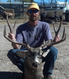
While elk hunting this season, I GPSed my shot location, and downloaded it into Google Earth.
The flag labelled 'Bowl' is where I shot from. There were 6 elk, including my bull, that emerged from the tree cover at the SW (lower left) part of the image, and fed in the lower green area for a half hour or so, before sundown. Then, just before the end of legal shooting light, they moved quickly along the tree line to the NE, and I dropped the bull at the 'Elk Kill' pin marker. The ruler feature says it's exactly 300 yards from me to the bull, as did my rangefinder.
I've been doing this for the past few years, pinpointing my locations on GPS and downloading them to Google Earth- kinda cool to relive where you were during the hunt.
I'd rather be a free man in my grave, than living as a puppet or a slave....
Cool! I was just doing something similar on Sunday--downloading GPS waypoints and tracks into Google Earth. It really helps me picture things in my mind as I think of jump off points to try new area.
Just so you know, Colorado's Ranching For Wildlife program isn't quite like hiring an outfitter to hunt private land.
First, the RFW licenses are limited (lottery only) cow tags and cost the same as any other resident limited license, $46. Depending on the ranch, you may be guided or not. In any case, RFW ranches cannot charge people with these licenses for the guide services.
Three Forks is an example of a ranch that provides guides. You ride in their vehicle and they are with you the entire time. Snake River has you follow the 'guides' in your own vehicle to the hunting spot you selected, where they point out pertinent details like property boundaries, then leave you to your own devices. You may or may not see them again.
Coyote Hunter - NRA Patriot Life, NRA Whittington Center Life, GOA, DAD - and I VOTE!
No, I'm not a Ruger bigot - just an unabashed fan of their revolvers, M77's and #1's.
I just tried this today. My shoot was down over and up some hills so I couldn't get a good measure from google. I did get the GPS cord's from there and then used another website to figure it out. It was 466 yards. Now I am guessing a little on the kill location but I think I'm very close. Oh ya this was my very first Deer kill.
If you don't have anything nice to say, you must be talking about Hilary Clinton.
When it's time to bury your guns it's time to dig em up.
Thanks for the thread Bighorn, I didn't even know it was possible to calculate yardage using google earth. I went back and marked the bull I shot this year and where I was shooting from and got a distance total of 605 yards.....which was beyond what I figured it was. No wonder my first couple shots hit low.
Easy, download Google Earth software-free. Use your GPS and save waypoint. Open GE, connect your GPS to your computer. Use the upload feature to download your GPS waypoints to GE.


![[Linked Image]](http://i5.photobucket.com/albums/y186/Geoclark/ElkKillSite.jpg)


![[Linked Image]](http://www.hunt101.com/data/500/Saturday_elk_on_ridge1.jpg)